Eagle Lake
Eagle Lake Kiteboarding Guide
Part of the State of Jefferson Kiteboarding Guide
June 2023 Update
After a decade long drought Eagle Lake finally had a significant 2022-2023 winter wet season which brought water levels back to those seen in 2012. Reports of good water quality had us eager to sample the lake once again. What we found was shocking. Due to unrestricted cattle grazing along the receded shoreline during the drought, a decade's worth of cow pies accumulated below the high water line. This introduced bovine biomass is now floating and breaking down in the now partially restored lake level. This new floating biomass made the once clear water almost opaque, at least on the windy day we visited. Let it be noted this condition was experienced in the north basin with a south west wind. Maybe other areas of the lake fared better? Until this biomass biodegrades and/or water levels rise increasing dilution, we can not recommend visiting for water recreation. This situation is almost criminal in our view. Cattle have degraded this once wonderful body of water to a cesspool. Hopefully the Bureau of Land Management will ban cattle grazing within close proximity to a shared water resource.
Intro:
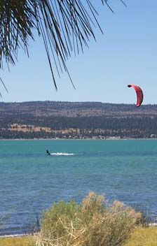
The shear size of Eagle Lake combined with a complex irregular shoreline offers the kiteboarder a variety of launch options and challenges. The southern part of the lake gets the most use from a variety of recreationalist and is where Eagle Lake Recreation Area can be found. The northern reaches of the lake offer more solitude and wide open space.

The following five paragraphs are quoted from the Bureau of Land Management Eagle Lake Field Office Website and provide an excellent introduction to Eagle Lake.
Eagle Lake is 5100 feet above sea level in north eastern California about 16 miles north of Susanville in Lassen County. It is the second largest natural freshwater lake wholly in California. Having no natural surface outlet, Eagle Lake is a closed basin lake with its water levels fluctuating with variations of inflow. Water surface areas have fluctuated between 16,000 to 29,000 acres with a present area of 26,000 acres.
The Lake and its immediate drainage are located in a high semi-arid plateau characterized by basaltic lava flows, volcanoes, and cinder cones. Some of the lava flows are fairly recent, having occurred not more than a few centuries ago. The higher western portion of the drainage basin consists mainly of volcanic mountains that form the east flank of the Cascade Range.
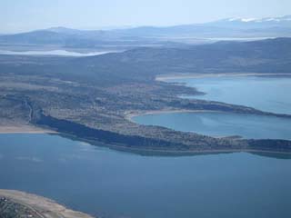
The Lake is irregular in outline, the main axis extending in a north-south direction for 13 miles. It varies in width from one-half mile to four miles and is divided into three sections
connected by channels. The northern section averages six feet in depth; the middle section has an average depth of ten feet; and the southern section reaches a maximum depth of 92 feet.
The northern and middle sections of the lake are bordered by sagebrush hills, and the southern end is forested with pine and fir. Surface water temperatures range from 32 degrees in winter to 80 degrees in summer. 
BLM photo
Land management around the lake is approximately 50% U.S. Forest Service, 35% Bureau of Land Management and 15% Private.
Launch:
Gallatin Beach: Located in the eastern part of the Eagle Lake Recreation Area. Please be courteous of other beach users in this popular campground. See directions below for Eagle Lake Recreation Area.
Rocky Point West: Rocky launch acrcoss the bay from the small town of Spalding.

BLM photo
From Susanville travel north on Highway 139 for 30 miles. Turn west (left) on County Road A-1 and travel approximately 6 miles. Turn south (left) at the bottom of a mile long grade. The town of Spaulding should be visible across the bay as you come down the grade.
North East Shore: A narrow strip of land between highway 139 and the lake offers a rocky launch and shallow waters. Winds are normally onshore so use caution with the road so close.
Hazards:
Think about where you will drift if you get into trouble. This is a big lake with difficult access in many areas.
Wind & Local Eagle Lake Data:
Check Susanville, CA for the closest weather data or:
NOAA Point Forecast
Val's Daily Eagle Lake Fishing Report: Wind data is NOT updated often enough for us wind junkies (near real time weather data would be nice, hint). However, this site contains interesting historical & cultural perspectives. Val also conveys an important message about the Lake which we support anywhere, but especially at extraordinary locations like this:
"All we ask of you is to respect the lake, its cultural heritage and all it has to offer. Please don't litter or urinate in the lake. It is a closed system."
Camping:
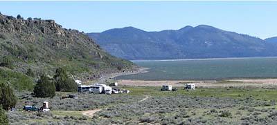
North Eagle Lake Campground (BLM): There are 20 developed sites available on a first come first served basis. The fee is $8 per night for a single site or $11 per night for multiple occupancy. Facilities include potable water, fire rings, picnic tables, lake access, RV (up to 35') or trailer sites, tent sites, trash removal, and vault toilets. Open mid May to Early November subject to seasonal weather conditions.
Directions: From Susanville travel north on Highway 139 for 30 miles. Turn west (left) on County Road A-1 and travel one half mile. Turn North (right) into the campground.
Eagle Lake Recreation Area (USFS) This is a US Forest Service Fee Area located at the south end of Eagle Lake and where Gallatin Beach can be found. This facility offers six different camp areas and a day use area. Warning: During fishing season expect early risers!
Primitive or self-containing camping is allowed on public lands. When camping, "Leave No Trace" so the area is as clean or cleaner than when you found it. Camp at least 200 feet from water sources to allow wildlife access to the water. Please respect private landowners, take a map and ensure that you are recreating on public lands.
Lodging:
Under construction
Eats:
Under construction
